.svg)
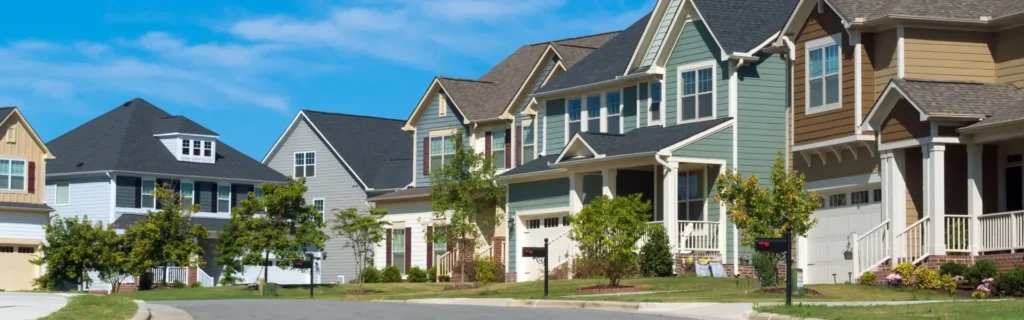
Australia’s safest suburbs
Which suburbs are safest for Australian residents?
When thinking about how safe a place is to live, crime is often the first thing that comes to mind. That’s true whether you’re choosing a new suburb or reflecting on the one you already call home. But safety goes beyond day-to-day crime, and some of the biggest risks to households aren’t always obvious until something goes wrong.
With this in mind, home and contents insurance comparison service iSelect looked beyond crime alone, analysing natural disaster exposure, building resilience, and disaster preparedness to better understand how safe suburbs across Australia really are. Each suburb was scored out of 100 for each factor, with the higher the index score, the safer the area.
The safest suburbs in Australia
New South Wales dominates the rankings for having Australia’s safest suburbs, claiming eight of the top 10. Leading the list is Canada Bay, which performs strongly across all four pillars of the index, particularly for low property crime, limited exposure to natural disasters, and a lower share of older housing.
Georges River and Willoughby follow closely in second and third place, with similarly high scores across property crime, natural disaster exposure, and building resilience, highlighting a broader pattern of safety across Sydney’s inner and middle-ring suburbs.
Western Australia is the only state to break NSW’s stronghold, with Rockingham and Cockburn ranking sixth and seventh overall. These suburbs have some of the lowest property crime rates among the top 10 and have limited exposure to natural disasters.
The most dangerous suburbs in Australia
At the other end of the index, the suburbs with the lowest overall safety scores are concentrated in Queensland and Victoria. Townsville, in North Queensland, ranks as the least safe suburb, with a high rate of property crime. The city also records relatively low or moderate scores across natural disaster exposure, building resilience, and disaster preparedness, contributing to its overall low index score of 41.65.
Other areas in Queensland, including Rockhampton, Cairns and Toowoomba, also feature among the lowest-ranked suburbs, while parts of Victoria, such as Yarra, Melbourne, Monash, Darebin and Yarra Ranges, round out the list. Across these suburbs, the combination of lower scores across all factors places them at the bottom of the safest suburb ranking.
Suburbs with the lowest property crime
Looking specifically at property crime, measured by reported offences such as burglary, theft, property damage, and arson, gives a sense of how secure residents are likely to feel in their homes. Ku-ring-gai in NSW tops the list, with the lowest average yearly rate of 451 offences per 100,000 people.
Other suburbs performing strongly include Wanneroo and Joondalup in northern Perth, WA, and Hornsby and Camden in Sydney, all recording positive property crime scores of over 98 out of 100. Overall, the top 10 suburbs consistently have low rates of property crime, highlighting areas where residents can expect higher levels of day-to-day security in their homes.
Suburbs with the highest property crime rate
At the other end of the scale, Queensland suburbs dominate the list of the highest property crime rates in Australia. Cairns tops the chart with a score of zero, recording an average of over 16,000 offences per 100,000 people each year, followed by Townsville with more than 15,500, reinforcing their reputations as areas with high crime. Rockhampton, in Central Queensland, rounds out the top three, showing that elevated property crime isn’t limited to the far north.
Other Queensland areas, such as Logan, Brisbane, Mackay, Toowoomba, and Ipswich, also feature, while Victoria is represented by Melbourne and the inner-city suburb of Yarra. These areas report higher property crime rates, reflecting the mix of dense residential and commercial zones where theft and burglary are more common.
Suburbs with the fewest natural disasters
The index also looked at areas’ exposure to natural disasters, including bushfires, severe storms, earthquakes, and floods.
Suburbs with the lowest natural disaster exposure are found across Victoria, Queensland, and New South Wales, often in coastal or well-developed metropolitan areas. Hobsons Bay in Victoria ranks lowest overall, with moderate storm activity and fire danger, historically recording 18 bushfires since 1898 and 140 severe storms between 2010 and 2021. Redland in Queensland follows closely, with 108 bushfires and 74 storms, including four rare waterspouts — tornado-like columns of rotating air over water — while Logan has experienced 128 bushfires and 224 severe storms, plus one tornado. Despite these events, both suburbs remain at a comparatively low risk.
Several New South Wales suburbs, including Ryde, Willoughby, Randwick, and Georges River, also rank low on this factor, showing that many inner- and middle-ring Sydney suburbs face fewer severe weather events. Coffs Harbour and the Sunshine Coast round out the list, where exposure to storms or floods is present, but overall disaster risk remains relatively low.
Suburbs with the most natural disasters
While some suburbs face relatively low natural disaster exposure, others, often in regional or coastal hubs where multiple hazards converge, are much more at risk.
The Central Coast in New South Wales tops the list for its particularly high flood risk. The area has recorded 68 flood events since 1989, alongside moderate storm and bushfire activity. Armadale in Western Australia follows, with bushfires dominating its risk profile, recording a staggering 2,427 events since 1989. Monash in Victoria faces severe storm exposure, with 1,109 storms between 2010 and 2021, with hail posing the biggest risk, including storms with hail stones the size of golf balls1https://www.abc.net.au/news/2020-01-19/melbourne-weather-hail-hits-outer-suburbs-fire-at-french-island/11880412.
Larger urban centres such as Brisbane, Townsville, and Darwin also appear high on the index, reflecting the reality that both metropolitan and regional areas can experience overlapping hazards, including storms, floods, and fire danger. Meanwhile, Melton in Victoria and Shoalhaven in New South Wales round out the top 10, where elevated bushfire and flood exposure contribute to higher overall risk despite limited earthquake activity.
Suburbs with the lowest concentration of older homes
The index also considered building age, since older homes may be less resilient to natural disasters and weathering, and can pose higher safety risks. Suburbs with the fewest pre-1980 residential buildings tend to have newer housing stock, often reflecting more recently developed areas.
Wyndham in Victoria has the lowest concentration, with just 11 older homes per 1,000 people, followed by Sydney City with 17 per 1,000 and Maribyrnong with 19 per 1,000. Other areas, such as Casey, Camden, and Canada Bay, also rank among the suburbs with the newest housing, indicating modern construction is more common in these areas.
Even suburbs further afield, like Wanneroo in Western Australia, show lower proportions of older homes than parts of Victoria and New South Wales, suggesting that newer housing is a nationwide factor in assessing local safety and disaster preparedness.
Suburbs with the highest concentration of older homes
On the other hand, suburbs with older homes can offer character, but also come with their challenges. Whitehorse in Victoria tops the list as the Australian suburb with the highest concentration of older homes, with 292 pre-1980 buildings per 1,000 people. Its score of 0/100 highlights that, compared with other suburbs, Whitehorse’s homes, which have historical, architectural, social, technological, cultural and/or scientific significance, are particularly exposed to natural hazards.
Many of the suburbs with the highest concentration of older homes are in Greater Melbourne, highlighting the city’s long-established residential areas. Alongside Whitehorse, suburbs such as Darebin, Banyule, and Monash also feature prominently, showing that older housing and the conservation and enhancement of these buildings are critical and widespread across Melbourne’s established suburbs.
Outside Victoria, Charles Sturt in South Australia ranks seventh with 264 older homes per 1,000 people, showing that higher concentrations of older housing are not just an east-coast phenomenon.
While older homes often have charm and larger plots, their age can mean more maintenance, outdated construction, and lower resilience to extreme weather, requiring extra care to manage potential risks.
Suburbs most prepared for disaster response
A suburb’s safety can also be measured by its emergency and disaster response. Areas with more SES facilities but fewer past DRFA activations (Disaster Recovery Funding Arrangements, which provide state aid after major incidents) are generally well-prepared for disasters, yet haven’t historically needed as much state assistance.
Queensland dominates the list of suburbs with the most equipment for disaster scenarios, reflecting both the high number of SES facilities and the lower frequency of DRFA activations in these areas. Mackay tops the ranking, with 15 SES facilities and just 18 activations, followed closely by Bundaberg and Fraser Coast.
Outside Queensland, the Unincorporated ACT appears mid-table, while South Australia has lower representation, with Port Adelaide Enfield and Onkaparinga rounding out the top 10. These areas also record low rates of DRFA activations, suggesting they have generally been safe from major disasters.
Suburbs least prepared for disaster response
In contrast to the best-prepared suburbs, several areas in Victoria and New South Wales are less equipped to handle disasters. Yarra Ranges in Victoria ranks lowest, with 46 instances requiring DRFA intervention, likely due to having only three SES facilities to support the community.
NSW suburbs such as Port Macquarie-Hastings, Central Coast, and Shoalhaven also appear, highlighting regional communities where emergencies occur relatively often, and local SES facilities may be stretched, potentially affecting recovery times.
Victoria’s Cardinia, Mornington Peninsula and Ballarat also appear, along with NSW’s Mid-Coast, Penrith and Shellharbour. Across these suburbs, the combination of fewer SES facilities and moderate-to-high activation counts results in lower overall scores, highlighting areas where residents may experience longer response times and greater reliance on external support during emergencies.

“Safety isn’t only about what happens on the streets. Factors like exposure to natural disasters, the age of local housing, and preparedness for emergencies all play a key role in determining a suburb’s real-world risk.
“Many of the safest-ranked suburbs perform consistently well across all these factors, which helps explain why they’re often seen as more stable places to live. On the flip side, areas with higher property crime or greater exposure to storms, floods, or older buildings may face more frequent or costly insurance claims.
“For homeowners and renters, this highlights why it’s important to look beyond postcodes alone and make sure your home and contents insurance reflects the specific risks of where you live. Even in suburbs that feel safe day-to-day, underinsurance can leave households exposed when the unexpected strikes.”
Adrian Bennett
General Manager – General Insurance
Written by:

Sarah Grealy
Digital Public Relations Specialist
![]() 0413 363 690
0413 363 690
Sarah is our Digital Public Relations Specialist, and brings more than a decade of experience in the insurance comparison industry to iSelect.
With a passion for storytelling through data-driven insights, Sarah strives to empower Aussies with practical guides and tips.
About the data
iSelect has analysed Australia’s top 100 most populated Local Government Areas (LGAs) to determine the safest locations for homeowners across the nation. The Home Safety Index assesses risk factors that directly impact the safety and security of owning a home, covering four key categories: Crime Risk, Natural Disaster Exposure, Emergency Response Activity, and Building Vulnerability.
Data was collected from the latest available state and federal government sources, including the Australian Bureau of Statistics (ABS), Geoscience Australia, the Bureau of Meteorology (BoM), and state crime statistics agencies. These factors were aggregated, normalised, and weighted to create an overall index score out of 100, allowing for a direct comparison of safety levels between different council areas.
| Category | Measure | Measure Weight | Category Weight | Direction |
| Crime Rate | Rate Per 100,000 Population | 100% | Negative | |
| Crime RateScore / 100 | 30% | |||
| Natural Disaster Exposure | Bushfire Score | 20% | Negative | |
| Fire Danger Index | 20% | Negative | ||
| Severe Storms Score | 20% | Negative | ||
| Maximum ground shaking intensity (PGA-0.1) | 10% | Negative | ||
| Mean ground shaking intensity (PGA-0.1) | 10% | Negative | ||
| Count of Flood Studies | 20% | Negative | ||
| Natural Disaster Exposure Score /100 | 30% | |||
| Building Exposure | Pre 1980 Residential Buildings Per 1000 People | 100% | Negative | |
| Building Exposure Score / 100 | 15% | |||
| Emergency Response Activity | Count of SES Facilities | 50% | Positive | |
| DRFA Activation Count | 50% | Negative | ||
| Emergency Response Activity /100 | 25% |
Notes on the Data
Datasets are accurate as at 4/2/2026.
Location Selection The study focuses on the top populated Local Government Areas (LGAs) in Australia, based on Regional Population data from the Australian Bureau of Statistics (ABS) for the 2023-24 financial year. This ensures the analysis compares established residential communities and avoids skewing results with sparsely populated remote regions.
– Tasmania does not appear in this index as no Tasmanian Local Government Areas (LGAs) ranked within the top 100 most populated areas in Australia, falling below the statistical cut-off for this specific study.
Crime Risk Crime scores were calculated using the rate of property-related offences per 100,000 people. Data was sourced from state and territory crime statistics agencies (e.g., BOSCAR in NSW) covering the period from October 2021 to September 2025.
- Offences included: Arson, property damage, burglary/break and enter, theft (motor vehicle, retail, bicycle, and other), and receiving stolen goods.
- Data was spatially joined from suburb-level reports to LGA boundaries where necessary.
Natural Disaster Exposure This category aggregates four distinct environmental risks into a single exposure score:
Bushfire: Utilising the Australian Government Digital Atlas – Bushfire History Geodatabase (1898–2025) and BoM Fire Danger Index. The score which weights both the total historical burnt area relative to the LGA size and the frequency of fire events. Note: Where direct data was unavailable for a specific LGA, an average was derived from the nearest neighbouring regions, so these figures should be treated as estimates.
- Severe Storms: Based on the BoM Severe Storms Archive, we created a weighted score for storm events including hail, lightning, rain, tornadoes, and wind, with more extreme storm types weighted higher. Events were normalised by LGA to identify storm hotspots.
- Earthquake Hazard: Sourced from Geoscience Australia’s National Seismic Hazard Assessment (NSHA18). We analysed Peak Ground Acceleration (PGA) values for bedrock. The final seismic score is a weighted calculation of the mean (70%) and maximum (30%) hazard values within each council area. Note: In instances where specific hazard data was missing, values were imputed using averages from the nearest LGAs; as such, these specific results should be interpreted with that estimation in mind.
- Flood Risk: Assessed using data from the Australian Flood Risk Information Portal (AFRIP) to identify flood-prone areas.
Emergency Response Activity To gauge the “lived experience” of safety, we analysed activity from the State Emergency Service (SES).
- Measures: This includes the count of SES facilities within the region, sourced from the Australian Government Digital Atlas broken down by LGA. It also incorporates historic counts of funding arrangements for disasters (e.g., for floods, storms, and rescues) between 2006 and 2025 sourced from data.gov.au data sets.
- Higher counts of DRFA contributed to a lower safety score, indicating a higher frequency of incidents requiring aid.
Building Vulnerability This factor assesses the resilience of the local housing stock.
- Measure: The number of residential buildings constructed pre-1980 per 1,000 people, sourced from the National Emergency Management Agency (NEMA) exposure data.
- Rationale: Older homes may be more susceptible to damage from natural hazards compared to those built to modern building codes (post-Cyclone Tracy reforms), representing a higher potential risk for homeowners.
iSelect does not compare all home insurance providers or policies in the market. The availability of policies will change from time to time. Not all policies available from its providers are compared by iSelect and due to commercial arrangements, your stated needs and circumstances, not all policies compared by iSelect are available to all customers. Some policies and special offers are available only from iSelect’s contact centre or website. Click here to view iSelect’s range of providers.
About 
At iSelect, we’re passionate about making Aussies’ lives easier by saving them time, effort and money. We are Australia’s go-to destination for comparison across insurance, utilities and personal finance products made available from our range of providers. Our service is provided at no cost to the customer.
iSelect General Pty Ltd (ABN 90 131 798 126. AFSL 334115) has partnered with Compare the Market (ABN 83 117 323 378. AFSL 422926) to compare a range of home insurers and policies. Not all providers in the market or all policies offered by the partners are compared and not all policies or special offers are available to all customers.
A number of our participating general insurance brands are arranged by Auto & General Services Pty Ltd ACN 003 617 909 on behalf of Auto & General Insurance Company Limited 111 586 353, both of which are related entities of iSelect Limited. Our relationship with those companies does not impact the integrity of our comparison service. Click here to view iSelect’s range of providers.
Any advice provided by iSelect is of a general nature and does not take into account your objectives, financial situation or needs. You need to consider the appropriateness of any information or general advice iSelect gives you, having regard to your personal situation, before acting on iSelect’s advice or purchasing any policy. You should consider iSelect’s Financial Services Guide which provides information about our services and your rights as a client of iSelect. iSelect receives commission for each policy sold that is a percentage of the premium or a flat fee. Ask us for more details before we provide you with any services.